


Austria is a largely mountainous country due to its location in the Alps. The Central Eastern Alps, Northern Limestone Alps and Southern Limestone Alps are all partly in Austria. Of the total area of Austria (84,000 km2
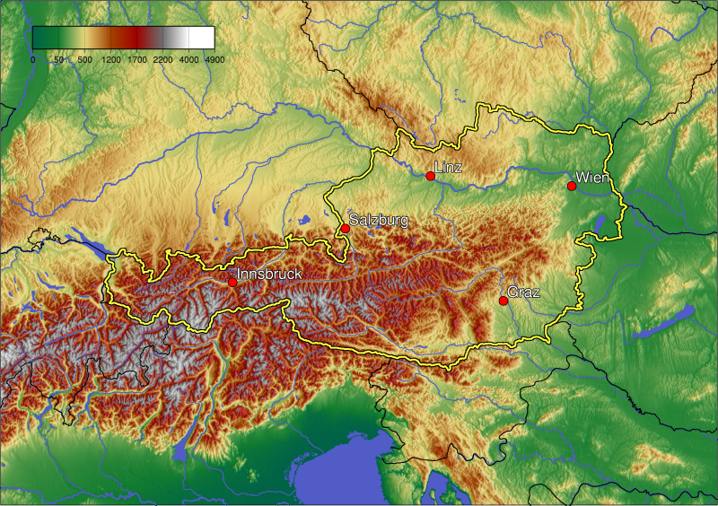
), only about a quarter can be considered low lying, and only 32% of the country is below 500 metres (1,640 ft). The Alps of western Austria give way somewhat into low lands and plains in the eastern part of the country.
Austria lies between latitudes 46° and 49° N, and longitudes 9° and 18° E.
It can be divided into five areas, the biggest being the Eastern Alps, which constitute 62% of nation's total area. The Austrian foothills at the base of the Alps and the Carpathians account for around 12% and the foothills in the east and areas surrounding the periphery of the Pannoni low country amount to about 12% of the total landmass. The second greater mountain area (much lower than the Alps) is situated in the north. Known as the Austrian granite plateau, it is located in the central area of the Bohemian Mass and accounts for 10% of Austria. The Austrian portion of the Vienna basin comprises the remaining 4%.Phytogeographically, Austria belongs to the Central European province of the Circumboreal Region within the Boreal Kingdom. According to the WWF, the territory of Austria can be subdivided into four ecoregions: the Central European mixed forests, Pannonian mixed forests, Alps conifer and mixed forests and Western European broadleaf forests.


0 comments:
Kommentar veröffentlichen